

Observing Components
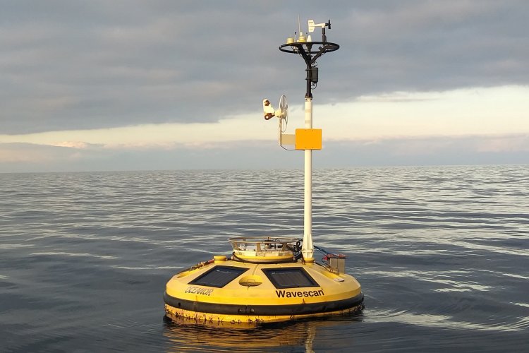
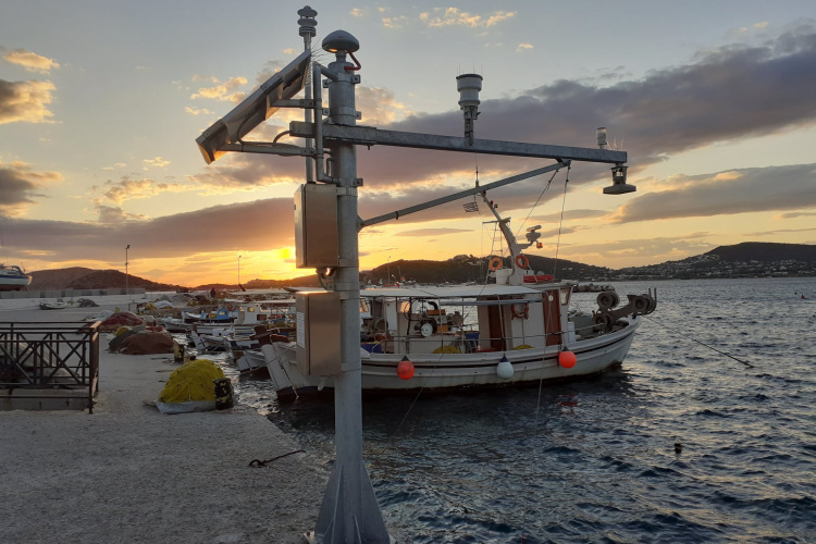
Moored buoys are anchored at fixed locations and regularly collect observations from many different atmospheric and oceanographic sensors. The long term recordings collected by the fixed stations can provide evidence on the ocean state and ocean variability, allow a better understanding on the several processes that take place in the marine environment,…
The main scientific objective of the European Strategy Forum on Research Infrastructures (ESFRI EMSO) is the long-term real-time observation of environmental processes and changes associated with the interaction between the geosphere, the biosphere and hydrosphere creating time series with super decadal data. Particular emphasis is placed on monitoring…
The objective of this component is to maintain a long time series of biogeochemical, biodiversity and ecosystem measurements in the Cretan Sea. These observations are essential reference points in the study of global change impacts on marine ecosystem biogeochemistry and biodiversity. For this purpose, since 2010, the Institute of Oceanography of HCMR…
The potential of using a Ship of opportunity (SOOP) network is the collection of marine observational data over vast areas of the world’s oceans that could not reasonably be covered with traditional research vessel efforts. Modern SOOPs are able to host automated systems providing high frequency data in real time and sampling in predefined coordinates…
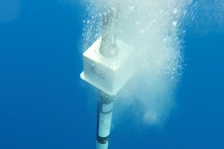
The Argo Floats are autonomous free-drifting profiling floats that descend to a target depth, drift for a predefined time period, and then descend again to a target profile depth to start the physical and biogeochemical parameters’ profile. During the last decades the Argo network has become an integral and necessary component towards ocean monitoring…
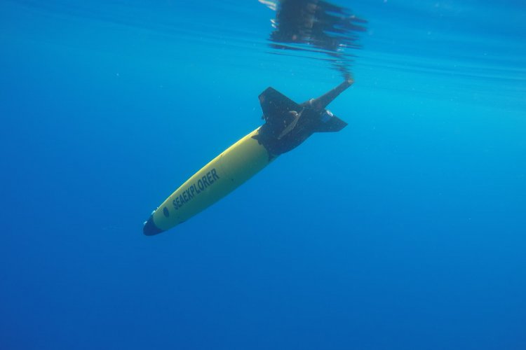
Ocean gliders are autonomous underwater vehicles used for ocean science. They travel in the seawater by changing their buoyancy and attitude in order to dive up and down successively, while they sample the seawater to collect oceanographic data. Gliders typically profile in a saw tooth pattern from the surface to 500 – 1000 m depth, travelling 3 – 6 km…
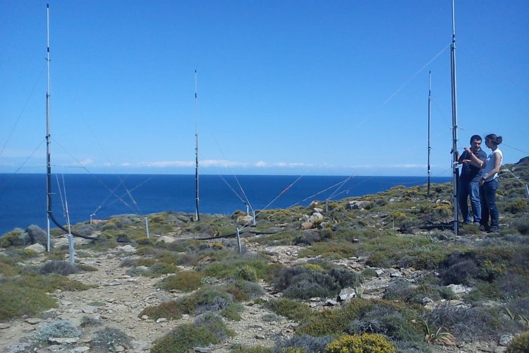
High frequency (HF) radar systems measure the speed and direction of ocean surface currents in near real time and in high spatial and temporal resolution over a large region of the coastal ocean, from a few kilometers offshore up to about 200 km, and can operate under any weather conditions. These high quality currents data are necessary for the…
Sea level is a critical variable of the marine environment which has a high impact on coastal populations. It constantly changes at every locality with the changes in tides, atmospheric pressure, wind conditions, temperature ocean variations which affect the density and the volume of the water, rainfall and river water flowing into the ocean. Longer-term…